Leaf River Fishing Spot
- Elevation: 478'
- Last Modified By: vinny60 on 09/13/09 12:30 PM
- Ask about Leaf River in our Fishing Forums
Photos
Fish Species
Leaf River Description
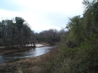
The Leaf River is a river, about 180 mi (290 km) long, in southern Mississippi in the United States. It is a principal tributary of the Pascagoula River, which flows to the Gulf of Mexico. The Leaf River rises in the Bienville National Forest in southwestern Scott County and flows initially southward through eastern Smith, northeastern Covington, western Jones and northern Forrest Counties to Hattiesburg, where it collects the Bouie River. Below Hattiesburg, the river turns southeastward and flows through central Perry and southwestern Greene Counties, skirting the edge of the De Soto National Forest, into northern George County, where it joins the Chickasawhay River to form the Pascagoula River. LEAF RIVER - Forrest, Perry, Greene Counties, Boat Ramps - Forrest County - Hwy 42 bypass East of Hattiesburg; Perry County - Hwy 15 at Beaumont; Perry County - off Hwy 29 at paper mill in New Augusta; Perry County - Farlow Landing, North on Hwy 29 from New Augusta, left on first blacktop road on left after crossing Leaf River, watch for ramp signs; Greene County - Hwy 98 at McLain.
The Leaf River is a river, about 180 mi (290 km) long, in southern Mississippi in the United States. It is a principal tributary of the Pascagoula River, which flows to the Gulf of Mexico.