Mississippi River Fishing Spot
- Elevation: 104'
- Last Modified By: vinny60 on 09/14/09 10:30 AM
- Ask about Mississippi River in our Fishing Forums
Photos
Fish Species
Mississippi River Description
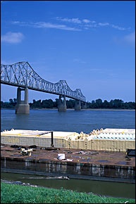
From its source at Lake Itasca, 1,475 feet (450 m) above sea level in Itasca State Park located in Clearwater County, Minnesota, the river falls to 801 feet (244 m) prior to St. Anthony Falls in Minneapolis. There it drops to 725 feet (220 m), creating the only waterfall along the river's course. The Mississippi is joined by the Minnesota River in Minneapolis, Minnesota, the Wisconsin River in Prairie du Chien, Wisconsin, the Illinois River and the Missouri River near St. Louis, Missouri, and by the Ohio River at Cairo, Illinois. The Arkansas River joins the Mississippi in the state of Arkansas. The Atchafalaya River in Louisiana is a major distributary of the Mississippi. The Mississippi drains most of the area between the Rocky Mountains and the Appalachian Mountains, except for the areas drained by Hudson Bay via the Red River of the North, the Great Lakes and the Rio Grande. It runs through two states — Minnesota and Louisiana — and was used to define the borders of eight states (the river has since shifted, but the state borders have not) — Wisconsin, Iowa, Illinois, Missouri, Kentucky, Arkansas, Tennessee, and Mississippi — before emptying into the Gulf of Mexico about 100 miles (160 km) downstream from New Orleans. Measurements of the length of the Mississippi from Lake Itasca to the Gulf of Mexico vary, but the EPA's number is 2,320 miles (3,733 km). It's easy to catch "the big one" when river fishing in Arkansas's more than 9,700 miles of streams, including the mighty Mississippi River, the state's namesake Arkansas River and the cliff-lined Buffalo National River. While canoeing and kayaking are popular activities in the Natural State, floating is not the only attraction on its streams. Some, like Sylamore Creek at the Blanchard Springs Recreation Area and the Little Missouri River at the Albert Pike Recreation Area, provide the state's best swimming holes. Campgrounds, cabins and resorts can often be found along Arkansas's waterways, which frequently have picnicking areas and parks with easy-access boat ramps. While etching itself a place in the American consciousness, the Mississippi River has marked mightily the land, the people and the culture of eastern Arkansas, a part of the nation’s largest alluvial plain. Known regionally as “the Delta” and stretching from Cairo, Ill., south to the Gulf of Mexico, the plain covers more than 15,000 square miles in Arkansas alone, including all or part of 27 of the state’s 75 counties. The river’s natural legacy can be seen in the region’s remnant wetlands and many oxbow lakes, including Arkansas’s largest natural lake, while its impact on human history is evidenced in historic river ports such as Osceola and Helena. The Delta Cultural Center, a state museum in Helena, explores the Mississippi’s natural and historical legacies and its influence on regional culture, especially Delta blues music. Helena’s Reach River Park provides a dramatic view from an elevated boardwalk of the river Mark Twain celebrated.
The Mississippi River[2] is the second-longest river in the United States,[3] with a length of 2,320 miles (3,730 km)[4] from its source in Lake Itasca in Minnesota to its mouth in the Gulf of Mexico.
